OSIRIS on Odin
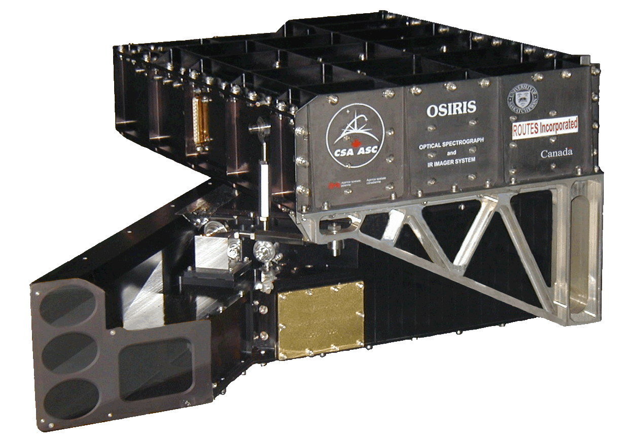
The Canadian designed and build Optical Spectrograph and InfraRed Imaging System (OSIRIS), is deployed and currently in operation aboard the Swedish Odin satellite.
OSIRIS measures vertical profiles of spectrally dispersed, limb scattered sunlight from the upper troposphere into the lower mesosphere and was launched February 2001 into a sun-synchronous, 6 pm / 6 am local time orbit at 600 km. This restricts OSIRIS sunlit observations to the Northern hemisphere in May, June, July August and the Southern hemisphere in November, December, January and February. Global coverage from 82°S to 82°N occurs on the months adjoining the equinoxes. OSIRIS measurements began November, 2001 and continue to the present. OSIRIS remains fully operational and processing of its data algorithm will be maintained into the foreseeable future.
To learn more about the history of OSIRIS on Odin, check out the following paper written by Dr. Chris McLinden from Environment and Climate Change Canada.
Objectives
The objective of the Odin mission is to provide new information on the extent to which humans are changing the atmospheric environment, specifically through the study of stratospheric and mesospheric ozone, and the coupling and energy budget of these regions.
Stratospheric ozone science: To elucidate the geographical extent of, and mechanisms responsible for, ozone depletion in the “ozone hole” region and to study dilution effects and possible heterogeneous chemistry even outside of the polar regions due to sulphate aerosols.
Coupling of atmospheric regions: To study some of the mechanisms that provide coupling between the upper and lower atmosphere, e.g., downward transport of NO with its effects on ozone photochemistry and the vertical exchange of minor species such as odd oxygen, CO, and H2O.
Instrument
The OSIRIS spectrograph measures from 274 nm to 810 nm with a single line of sight that is scanned through a range of tangent altitudes. Each scan typically ranges from 7 km to 65 km and takes 40 seconds to acquire. The measurements are used to produce height profiles of O3, NO2, and stratospheric aerosols.
The Odin satellite was operated until June 2007 as a joint mission between astronomy and aeronomy disciplines. 50% of the total observation time was dedicated to each discipline where time was split into 1 day segments. Odin has operated as a purely aeronomy mission since June, 2007, and continues to the present, with almost complete coverage.
OSIRIS is a Canadian instrument funded by the Canadian Space Agency. The mission PI is Dr. Doug Degenstein at the University of Saskatchewan. Dr. Adam Bourassa (University of Saskatchewan) and Dr. Chris McLinden (Environment and Climate Change Canada) are both Deputy PI's. Odin is operated with funding from the Swedish National Space Agency, as well as funds from the European Space Agency as a Third Party Mission.