Overview
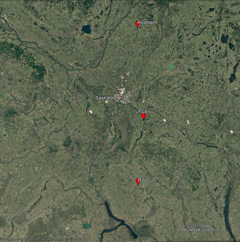
To support studies of agricultural-water interactions on the Canadian Prairies, the Centre For Hydrology has instrumented a number of sites across the region. Current research is associated with the Agricultural Water futures project (https://uwaterloo.ca/agricultural-water-futures/) of the Global Water futures program. The overall objective of this works is to improve our understanding of crop-climate-hydrology interactions for crop and livestock production systems throughout Canada. The Centre for Hydrology leads the prairie component of this work and active field sites span a number of locations including; the Livestock and Forage Centre for Excellence near Clavet SK, Brightwater Creek, near Kenaston SK, and Rosthern SK. The main focus of the work at these research sites is agro-hydrology infrastructure, but they also support additional complimentary research on prairie snow processes, runoff generation and wetland evaporation.
Livestock and Forage Centre for Excellence
Background
The LFCE is an independent unit of the University of Saskatchewan which opened in 2018 and is located near Clavet, 30 km SE of Saskatoon SK. The LFCE is a collaborative initiative led by the College of Agriculture and Bioresources and the Western College of Veterinary Medicine, integrating resources for livestock and forage research and development to improve the profitability and sustainability of livestock and forage industries. University owned facilities and resources at the Clavet facility included 2400 acres of land base, a 1500-head beef cattle feedlot, and a cow-calf research and teaching unit.
Complimentary environmental monitoring from other research units include an extensive ground water observation well network, soil moisture observations, and water quality monitoring in a prairie pothole depressional landscape
Land use in the vicinity of the LFCE is a mix of livestock/forage operations and annual cropping of oilseeds, cereals and pulses. Soils tend to be lighter (sandy-silt-loam) and precipitation is limited (353 mm Canadian Cliamte atlas). The LFCE area is especially valuable to study crop-water-climate responses to sandy soils and moisture stresses. Center for Hydrology activities at this site since 2018 have focused on the installation and maintenance of an intensive hydrometeorological monitoring program.
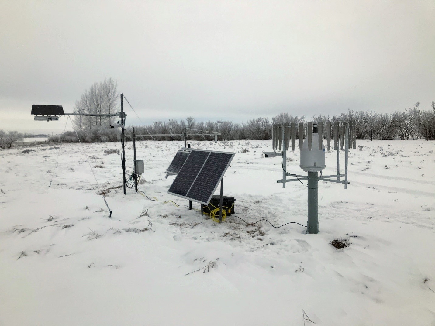
Reference meteorological site
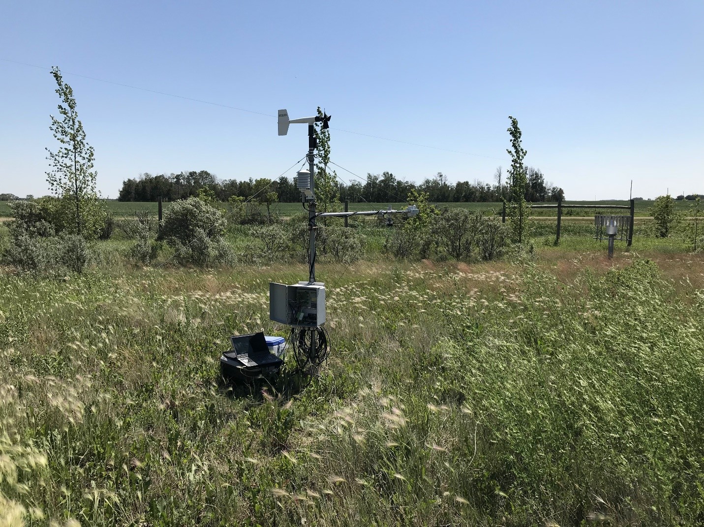
A meteorological reference station was installed a sheltered portion of the LFCE in late 2019. This permanent site comprises a standard suite of meteorological sensors observing all-weather precipitation, temperature, humidity, pressure, wind, and snow depth. This site also serves as a testbed for emerging intermittent techniques including the Chione snow acoustics sensing system being developed in the Smart Water Systems Laboratory (link?).
Realtime Data Telemetry link: http://giws.usask.ca/telemetry/ (from dropdown SK Agricultural Sites, then ClavetMetPrecip)
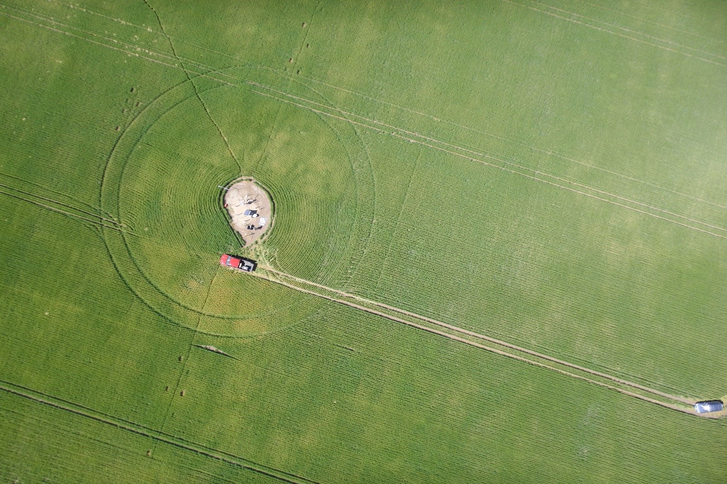
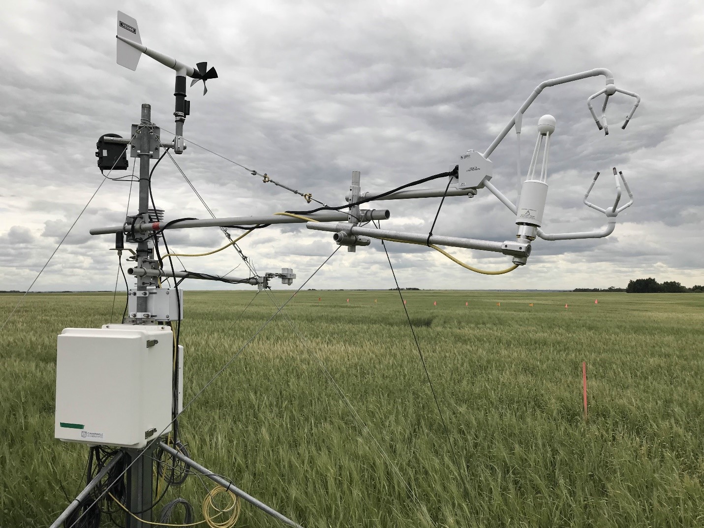
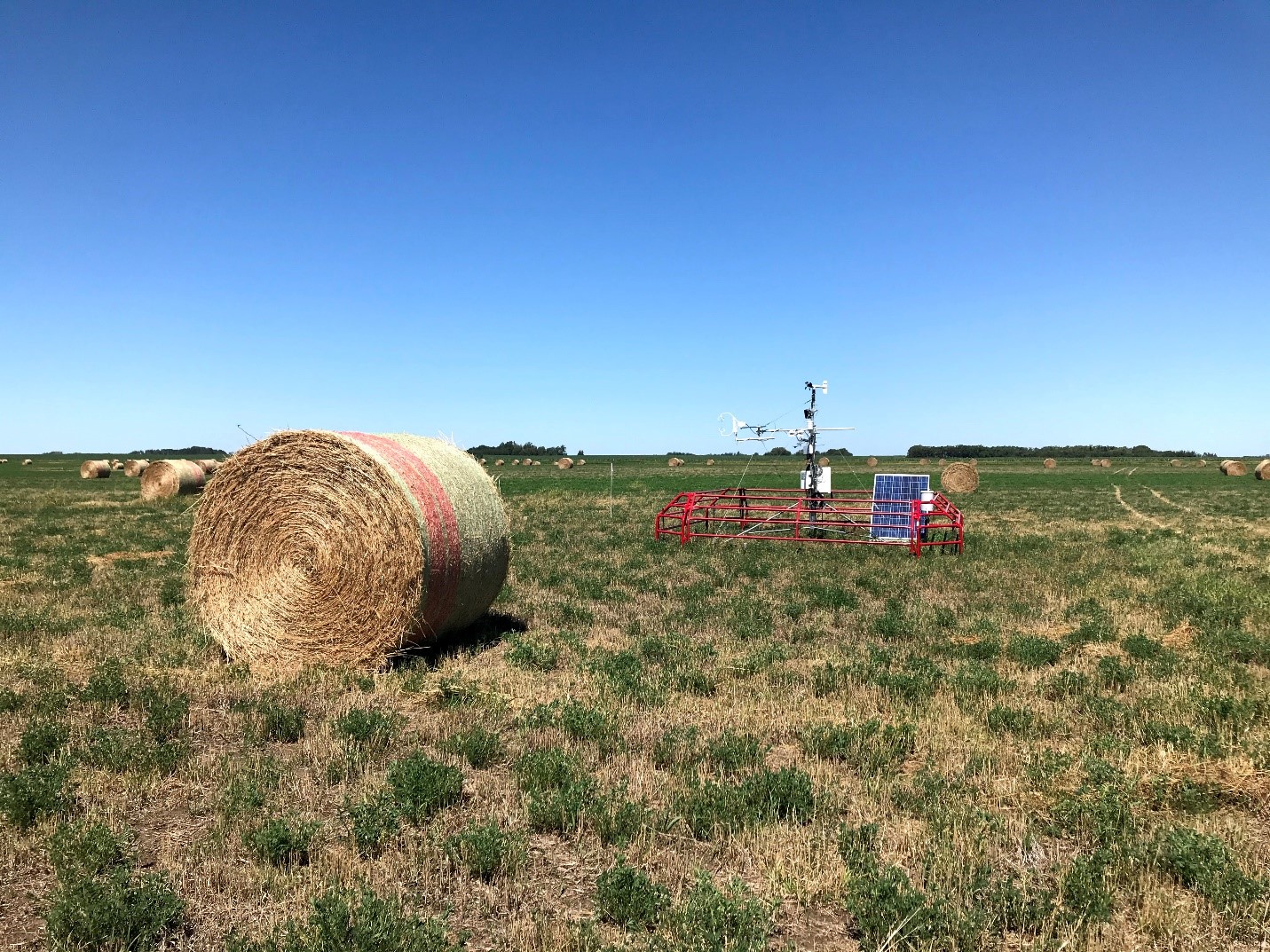
Micrometeorological and soil moisture monitoring sites
At a perennial forage and an annual crop (barley silage) site identical monitoring systems have been deployed since spring 2018 monitoring all components of the surface energy and water balance. These exchanges between the surface and atmosphere are observed with eddy covariance instrumentation, four component radiometers, ground heat flux plates, soil temperature and moisture probes and temperature, wind speed, and humidity sensors. During growing season frequent sites visits monitor soil moisture profiles with neutron probes and crop growth metrics (LAI and biomass).
Realtime Data Telemetry link http://giws.usask.ca/telemetry/ (from dropdown SK Agricultural Sites, then Clavet Barley Silage and Clavet Forage)
Brightwater Creek
Background
Brightwater creek, 90 km south of Saskatoon SK, was initially instrumented in the early 2000’s as an ECCC initiative to develop a large scale soil moisture observation network. The University of Saskatchewan’s GIWS took over management of a number of the sites in 2011. Land use in the vicinity of BWC sites is predominately annual cropping of oilseeds, cereals and pulses. Soils tend to be heavier (clay-loam) with localized salinity issues and precipitation is limited (354 mm Canadian Climate atlas).
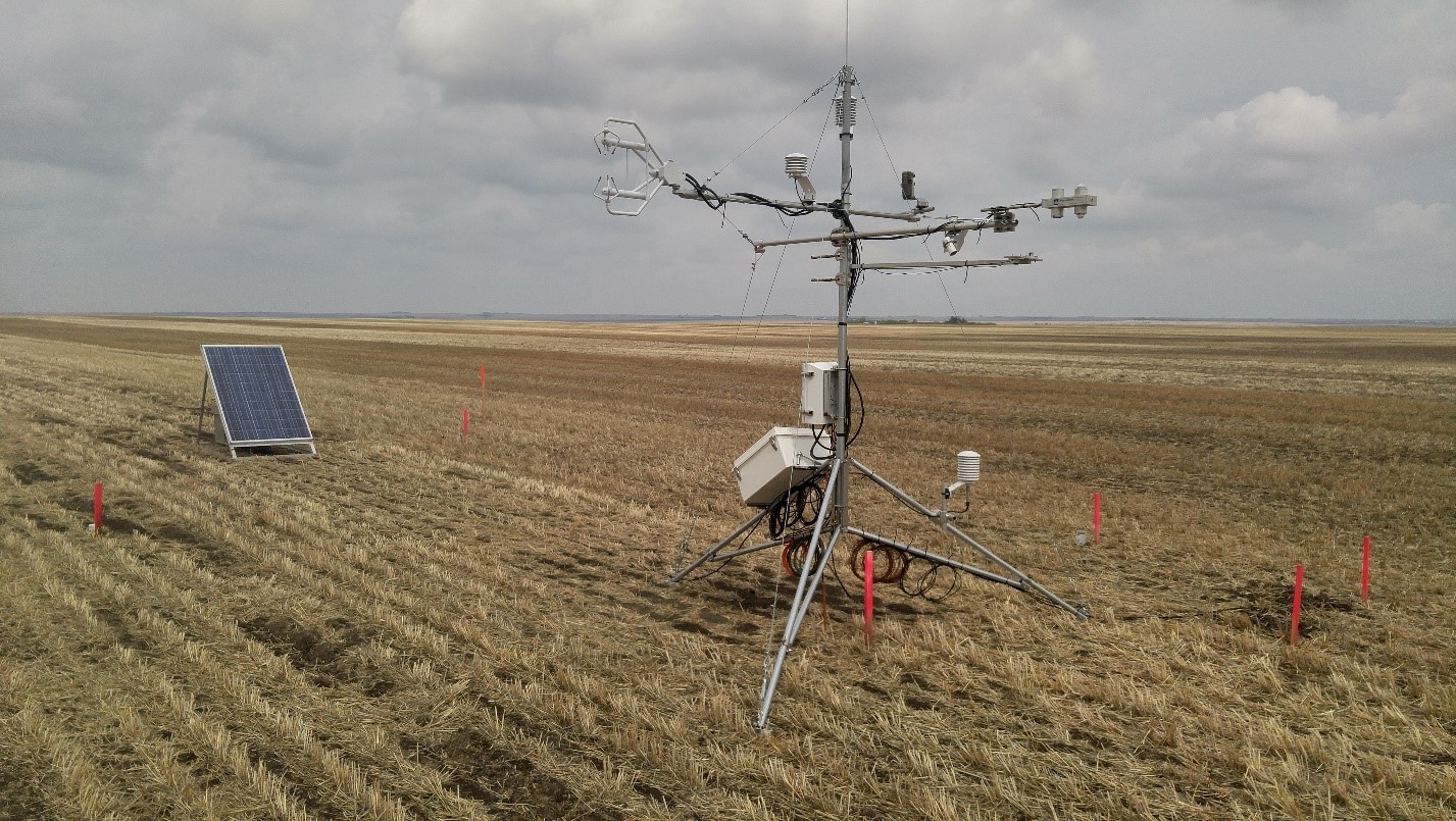
Current Center for Hydrology work is focused on a subset of these sites, primarily two annually cropped fields SE13 and SW30, which have insitu micrometeorological and soil moisture observations analogous to the LFCE micrometeorological and soil moisture sites. The SE13 site has been operated continuously since 2014 and the SW30 site in 2018-2019
Rosthern
Background
The Rosthern SK site, 70 km north of Saskatoon SK, was first instrumented in 2014 in support of a research project on the interactions of stubble management and snowmelt processes. Land use in the area is predominantly annual cropping of oilseeds, cereals and pulses. Soils tend to be heavier (clay-silt) and precipitation is greater than the more southerly LFCE and BWC sites (382 mm from https://climateatlas.ca/). This site is especially valuable to study crop-water-climate responses to heavier soils with reduced moisture stress. The meteorological reference station setup at this site has remained in operation continuously since fall 2014 observing short and longwave radiation, air temperature, humidity, wind, snow depth and all season precipitation. Installation of infield micrometeorological and soil moisture sites analogous to LFCE and BWC is planned for the 2021 growing season.
Realtime Data Telemetry link http://giws.usask.ca/telemetry/ (from dropdown SK Agricultural Sites, then Rosthern)
UAS Operations
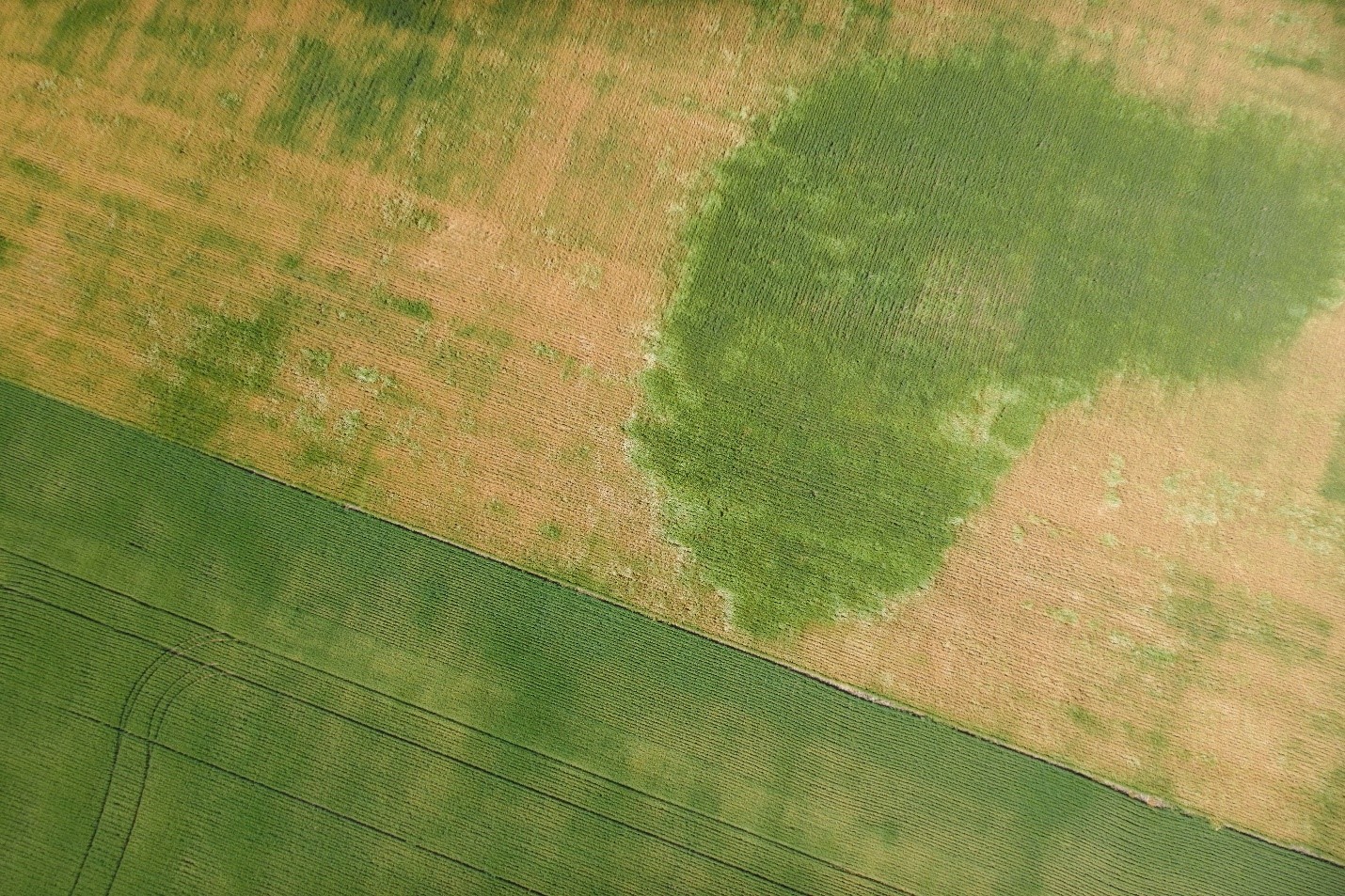
The UAS (unoccupied aerial systems) fleet of the Smart Water Systems Laboratory has been deployed to conduct extensive high-resolution remote sensing of crops at all sites. Ongoing work is using lidar, hyperspectral, multispectral, thermal and optical sensors from multirotor and fixed wing platforms to quantify the spatial variability of crop growth and land atmosphere interactions. Spatial scaling of process representations, interpretation of flux footprints, and precision agriculture applications are active research areas.
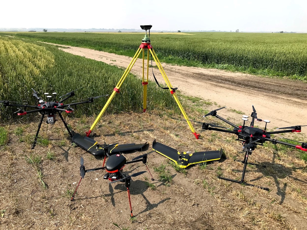
Part of the SWSL UAS fleet August 2018 includes DJI M600 with reigl miniVUX1-UAV lidar (leftmost), Ebee+ with ThermoMap thermal camera (second from left), Draganfly commander with MicaSense multispectral camera (from centre), Ebee RTK with Sequoia multispectral camera (second from right), DJI M600 with Corning hyperspectral imager, and Leica GNSS base station (back centre).
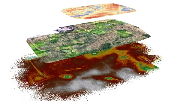
Sample datasets of thermal (top), optical (middle), and lidar (bottom) UAS observations. These multi-sensor high-resolution geospatial data provide highly detailed observations of crop growth characteristics that help to understand crop-water interactions across the field scale.
Saskatchewan site map